
Join the mailing list Free weekly briefing, no spam.
Cover Image Credits: General Dynamics Mission Systems
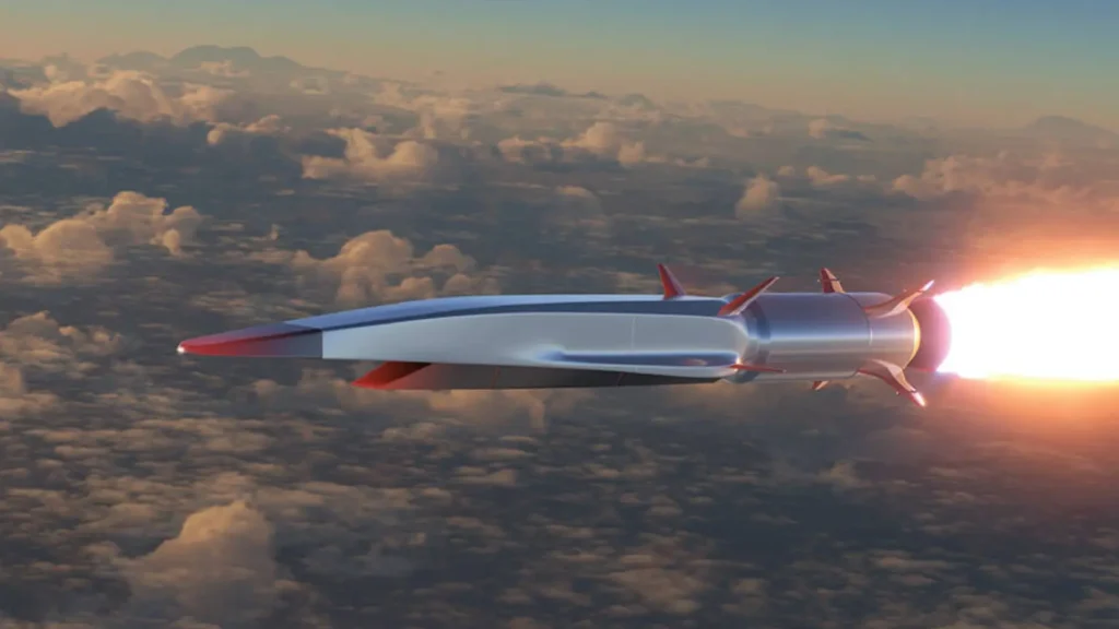
General Dynamics Mission Systems says it has flown a GPS-denied navigation receiver on a hypersonic test aircraft. The announcement is real and the engineering problem behind it is hard, but the public details are thin. This article separates what was announced from what was not, and explains the signal physics that make navigation at Mach 5 difficult: Doppler shift, tracking-loop dynamics and inertial aiding.
Key takeaways
- On October 7, 2026, General Dynamics Mission Systems (GDMS) announced a flight demonstration of its MO-Nav receiver on Stratolaunch’s Talon-A, a reusable test vehicle described as capable of Mach 5 or higher.
- The published reports give no accuracy figure, no speed reached, no altitude, no list of signals used and no statement about jamming. The flight shows a receiver operating in a hypersonic environment. It does not show a verified navigation solution under attack.
- At Mach 5 to 6, vehicle motion alone shifts the GPS L1 carrier by up to about 8 to 9 kHz. Adding the satellite’s own motion, the total can approach 14 to 15 kHz.
- The harder problem is how fast that shift changes. Acceleration and jerk push a receiver toward wide tracking bandwidth, while jamming resistance needs narrow bandwidth. An inertial measurement unit (IMU) is the usual way to resolve the conflict.
What did General Dynamics announce?
GDMS announced the demonstration on October 7, 2026. It was carried out with the U.S. Army DEVCOM Aviation and Missile Center (AvMC). Talon-A is Stratolaunch’s reusable, air-launched test vehicle, carried aloft by the Roc carrier aircraft.
MO-Nav (Multiple Orbit Navigation) is a single-board, software-defined receiver. It is designed to take navigation data from several sources: GNSS constellations other than GPS, commercially provided positioning, navigation and timing (PNT) services, and radio-frequency signals of opportunity, which are transmissions never designed for navigation. GDMS also reports an earlier cannon-fired artillery test in which the receiver survived launch loads and passed signal measurements to the munition’s mission computer. The company says MO-Nav is available for integration now.
What the public reports do not say
| Item | Status in public reports |
|---|---|
| Speed reached on the demonstration flight | Not stated |
| Altitude and flight duration | Not stated |
| Navigation accuracy | Not stated |
| Which GNSS, commercial or opportunity signals were processed | Not stated |
| Antenna type and location | Not stated |
| Use of an IMU | Not stated |
| Whether the flight ran under GPS denial or jamming | Not stated |
| Exact flight date | Not stated |
A receiver that combines several GNSS constellations is not free of satellites. It is free of dependence on GPS alone. That is a useful capability, but it is a narrower claim than “GPS-free navigation”.
How large is the Doppler shift at Mach 5 and Mach 6?
The Doppler shift equals the line-of-sight velocity divided by the carrier wavelength. GPS L1 is 1575.42 MHz, so the wavelength is about 19.0 cm. The altitude of the flight is not public, so we assume a speed of sound of about 295 m/s, typical at 20 to 25 km.
| Mach number | Speed | Maximum Doppler from vehicle motion at L1 |
|---|---|---|
| 5 | about 1.48 km/s | about 7.8 kHz |
| 6 | about 1.77 km/s | about 9.3 kHz |
The satellite’s own motion adds up to about 5 kHz for a stationary user. At Mach 6 the combined shift can therefore reach roughly 14 kHz, about three times the 5 kHz search range usually assumed for a receiver on the ground. A larger search range is an inconvenience. It is not the real obstacle.
Why do acceleration and jerk matter more than the offset?
A fixed Doppler offset can be found by searching. The trouble starts when the offset changes while the receiver is trying to track it. Acceleration produces a Doppler rate: 50 m/s² (about 5 g) gives about 260 Hz per second at L1. Jerk, the rate of change of acceleration, produces a change in that rate: 100 m/s³ gives about 525 Hz per second squared. These values are illustrative and are not Talon-A flight data.
Receivers track the carrier with a phase-locked loop (PLL) or a frequency-locked loop (FLL). The PLL measures phase and is precise, but it loses lock under stress. The FLL measures frequency only. It tolerates dynamics better and is noisier, so receivers often fall back to it during hard maneuvers.
The PLL design is a trade between two errors. Thermal noise grows with the loop noise bandwidth Bn. Dynamic stress error shrinks as Bn grows. For a third-order PLL, the steady-state error from jerk is the phase jerk divided by the cube of the natural frequency, with Bn of about 0.7845 times that frequency. With the 100 m/s³ example:
| Loop bandwidth Bn | Dynamic stress error | Result |
|---|---|---|
| 18 Hz | about 16° | Within the common limit of 45° total (3-sigma) design error |
| 10 Hz | about 91° | Beyond the limit, lock is lost |
| 5 Hz | about 730° | Far beyond the limit |
A receiver built to survive jamming wants a bandwidth of a few hertz, because each halving of Bn buys roughly 3 dB of thermal-noise margin. The vehicle dynamics push the other way. Without outside help, the two requirements cannot both be met.
How does an IMU resolve the conflict?
An IMU measures acceleration and rotation rate without any radio signal. If the receiver knows how the vehicle is moving, it can predict the Doppler shift on each satellite and steer its numerically controlled oscillator accordingly. The loop then only has to follow the small residual error, so Bn can drop to a few hertz. There are three common levels of integration:
- Loose coupling: the receiver computes its own position and velocity, and a filter blends them with the IMU. The IMU does not help tracking.
- Tight coupling: a Kalman filter uses the raw pseudorange and Doppler measurements of each satellite, and can feed a Doppler estimate back to the tracking loops. It still works with fewer than four satellites.
- Deep (ultra-tight or vector) coupling: the tracking loops are folded into the navigation filter, so one estimate of position and velocity steers every channel. A strong signal then helps hold a weak one.
The IMU is not free of error. Its drift grows with time, and the satellite measurements bound it. The grade of the IMU decides how long the system can coast through a jamming episode. The public material does not say whether MO-Nav was inertially aided on this flight.
What about plasma, heating and the antenna?
At Mach 5 the ionization of the air is limited, and the long communication blackouts known from reentry-class speeds are not the main concern. Aerodynamic heating is. For an ideal gas at Mach 5 and 25 km altitude, with an ambient temperature near 220 K, the total temperature is roughly 1,300 K. The antenna and its radome have to survive that heat and stay transparent at L-band. Their position also decides which satellites remain visible during maneuvers and body shadowing. Antenna design is missing from the public release, and it largely determines how representative the test was.
What do signals of opportunity add, and what do they cost?
Low Earth orbit satellites sit far closer than GNSS satellites, which orbit near 20,000 km. Their signals arrive stronger and are harder to jam. Their fast-changing geometry also carries rich Doppler information for positioning. The costs are real: the signals were not designed for navigation, orbit and signal details are controlled by the operator and not always documented for that use, and the satellites move at around 7 km/s, so their own Doppler is much larger than for GPS. GDMS has not said which sources were used in the flight.
Where do MOHAWK and M-Code fit?
MOHAWK (Multiple Orbit Highly Assured Weapons Kit) is the planned successor. GDMS and DEVCOM AvMC are co-investing in a hypersonic demonstration of MOHAWK with integrated M-Code in 2027, followed by precision-guided munition demonstrations in 2028. M-Code is the encrypted military GPS signal designed to resist jamming and spoofing. The stated options are an integrated M-Code receiver or an external M-Code receiver that provides a protected RF output. Reporting on the announcement notes that the more advanced capabilities still need validation before operational use.
What would turn this into proof?
- Position and velocity error measured against a trusted reference trajectory.
- A test under real or simulated jamming and spoofing, with J/S levels reported.
- The IMU grade and coupling architecture.
- The antenna design, placement and thermal protection.
- The speed, altitude and duration actually flown.
- Results from the 2027 MOHAWK demonstration.
Our assessment
This is a credible step up the technology readiness ladder. A compact, software-defined multi-source receiver has now been exposed to a severe dynamic environment, which matters for anyone designing guidance for high-speed weapons or test vehicles. It is incremental, though. Without accuracy and jamming data, the flight supports “the receiver works in this environment” and not “hypersonic vehicles can navigate reliably without GPS”. Those are separate claims, and the second one is the one the headlines imply.
Frequently asked questions
What is MO-Nav?
MO-Nav (Multiple Orbit Navigation) is a single-board, software-defined navigation receiver from General Dynamics Mission Systems. It can use several GNSS constellations, commercially provided PNT services and radio-frequency signals of opportunity. GDMS says it is available for integration now.
Does MO-Nav navigate without GPS?
The public reports describe a receiver that is not limited to GPS signals. They do not say whether the Talon-A flight was run with GPS denied, whether it faced jamming, or what accuracy it achieved. “GPS-free” in the headline is broader than what has been published.
Why is Doppler shift a problem for a hypersonic GPS receiver?
A receiver must lock onto the carrier frequency of each satellite signal. At Mach 5 to 6 the vehicle motion alone shifts the L1 carrier by up to about 8 to 9 kHz, and the satellite adds up to about 5 kHz. Acceleration and jerk then change that shift quickly, which can break the tracking loops.
Why do hypersonic navigation receivers use an IMU?
An inertial measurement unit senses acceleration and rotation without radio signals. Feeding that data to the receiver lets it predict the Doppler shift, so the tracking loops only follow a small residual. That allows much narrower loop bandwidth and better resistance to jamming.
Does Mach 5 cause a plasma communications blackout?
Not in the way reentry vehicles experience it. At Mach 5 air ionization is limited. Aerodynamic heating and antenna or radome survivability are the bigger concerns. Heavier plasma effects belong to higher Mach numbers.
Sources and method
- Defence Industry Europe, “General Dynamics demonstrates navigation without GPS on Talon-A hypersonic aircraft”, October 8, 2026.
- Army Recognition, “U.S. Army tests GPS-denied navigation on Mach 5 hypersonic aircraft for future weapons”, October 13, 2026.
- Interesting Engineering, “Hypersonic test shows GPS-free navigation”, October 2026.
- Kaplan, E. and Hegarty, C., Understanding GPS/GNSS: Principles and Applications, for PLL design criteria.
- GPS L1 carrier frequency of 1575.42 MHz as defined in IS-GPS-200.
All Doppler and tracking-loop figures in this article are our own calculations from the stated assumptions. They are not flight data and not figures published by GDMS or Stratolaunch.
Written by The SpaceInfo Club. Technical analysis by Sebastiano, an aerospace engineer who runs SpaceInfo Club. Published October 16, 2026.